Stunning Photos Will Make You Feel The Lava's Heat In Hawaii
Hawaii's Kilauea volcano that started erupting on May 3 continues to spew red-hot lava into residential neighborhoods as it flows downslope and into the ocean.
And now, nearly two months later, the eruption seems to have no end in sight. Meanwhile, the flow has destroyed at least 637 homes, covered 9.6 square miles of land, and formed 390 acres of new land off the coast of Hawaii's Big Island.
Recent photos give a sense of scale to the destructive eruption.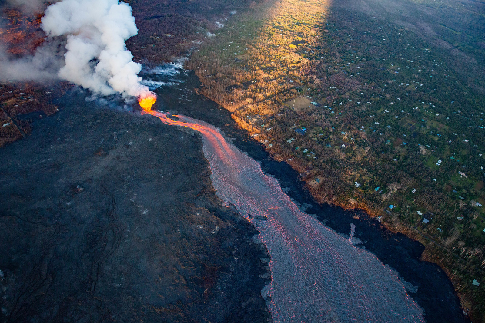
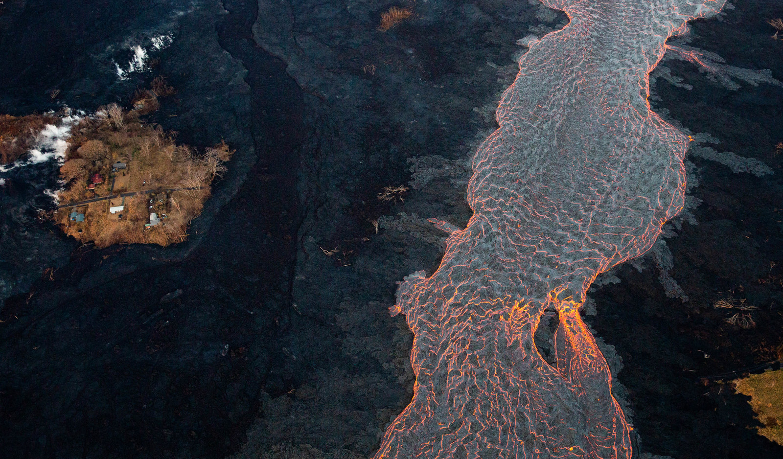
Some homes in Leilani Estates remain standing, while much of the neighborhood is covered in lava.
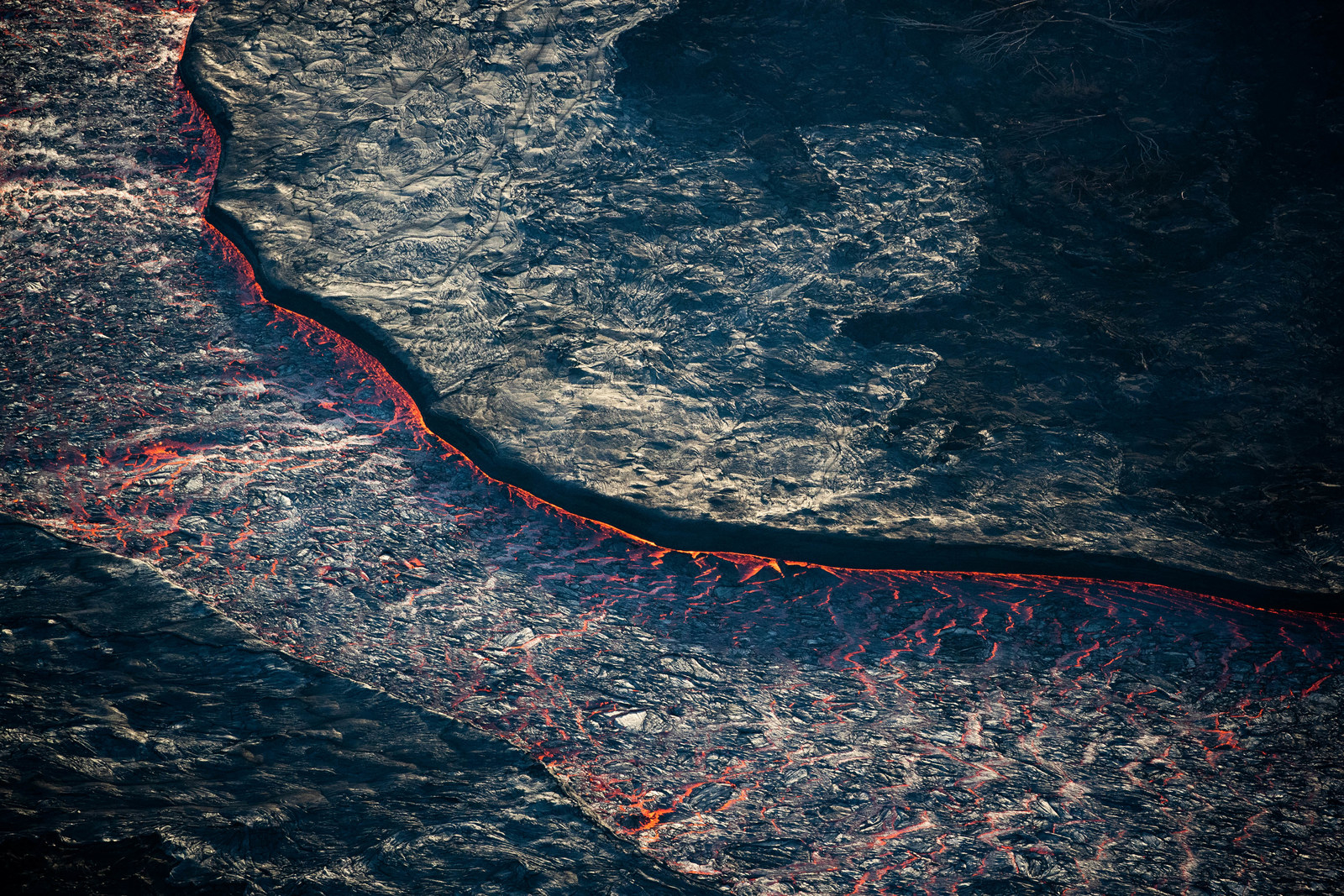
A river of red-hot lava is seen flowing through a channel of hardened lava. At its peak, the lava has moved as fast as 22 mph.
 Terray Sylvester / Reuters
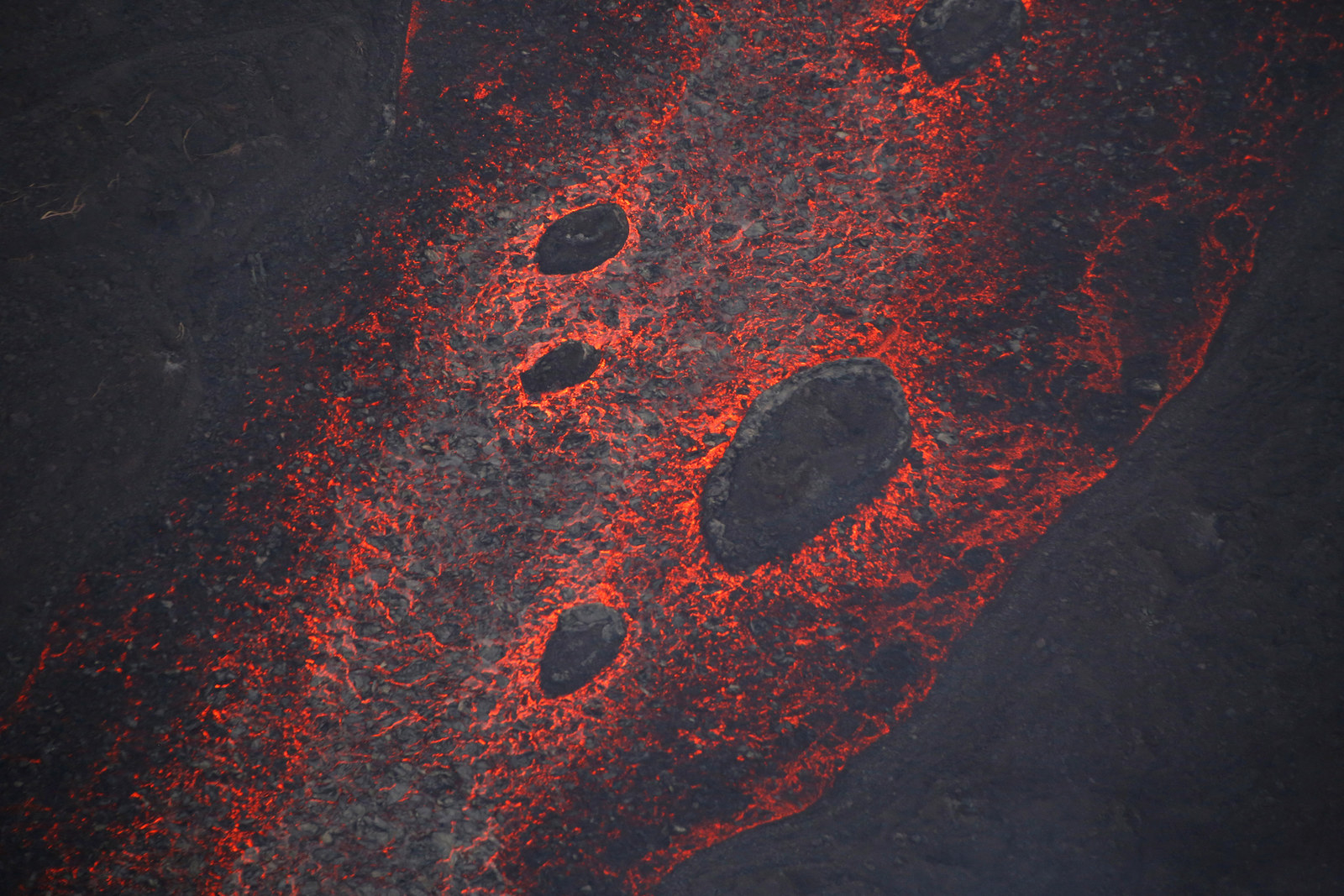
 Chunks of hardened lava — dubbed by sightseers as "lava bergs" — float in a river of lava.
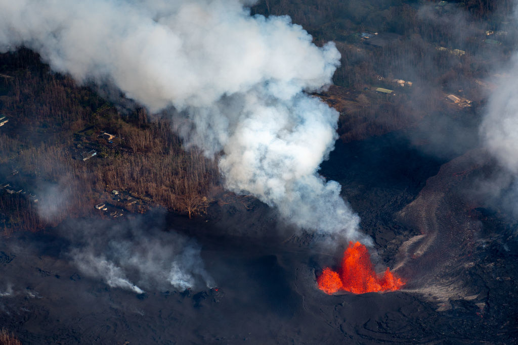
A plume of sulfuric acid, which is extremely dangerous in high concentrations, is also rising from a fissure. Last week, officials said 25,000 tons of sulfuric acid was emitted from the volcano.
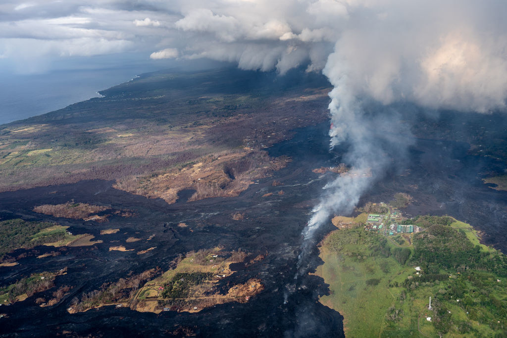
This aerial photo shows how lava partially covered a geothermal plant in the area.
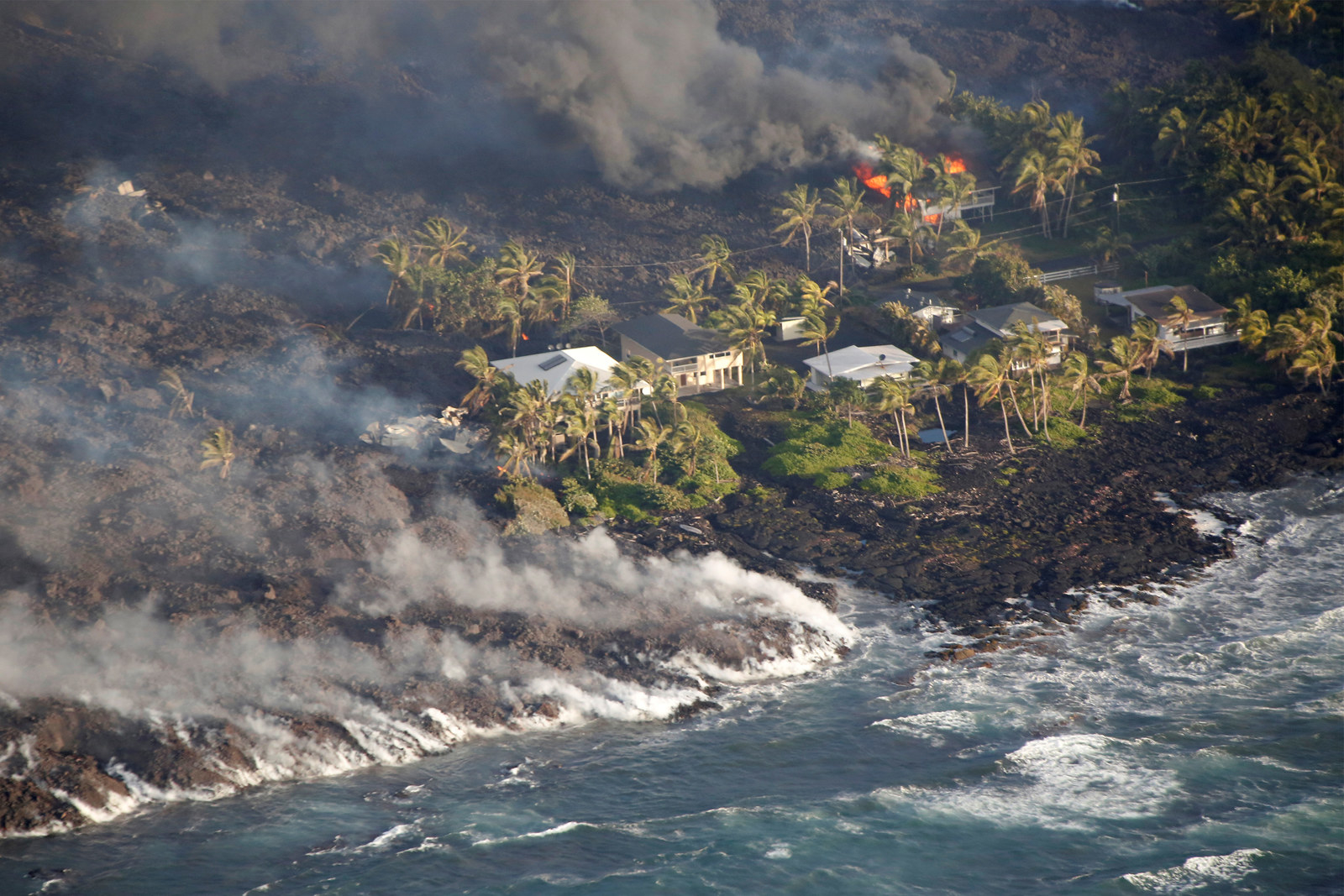
Homes burn from lava that also flowed into the ocean near Kapoho.
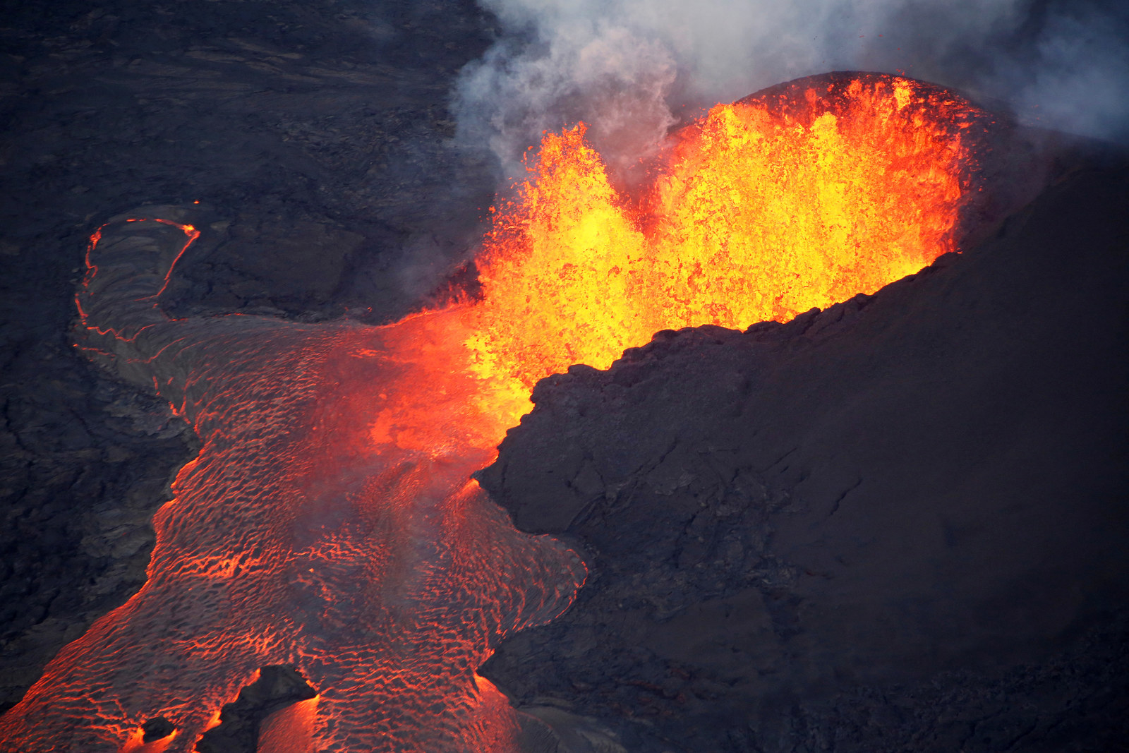
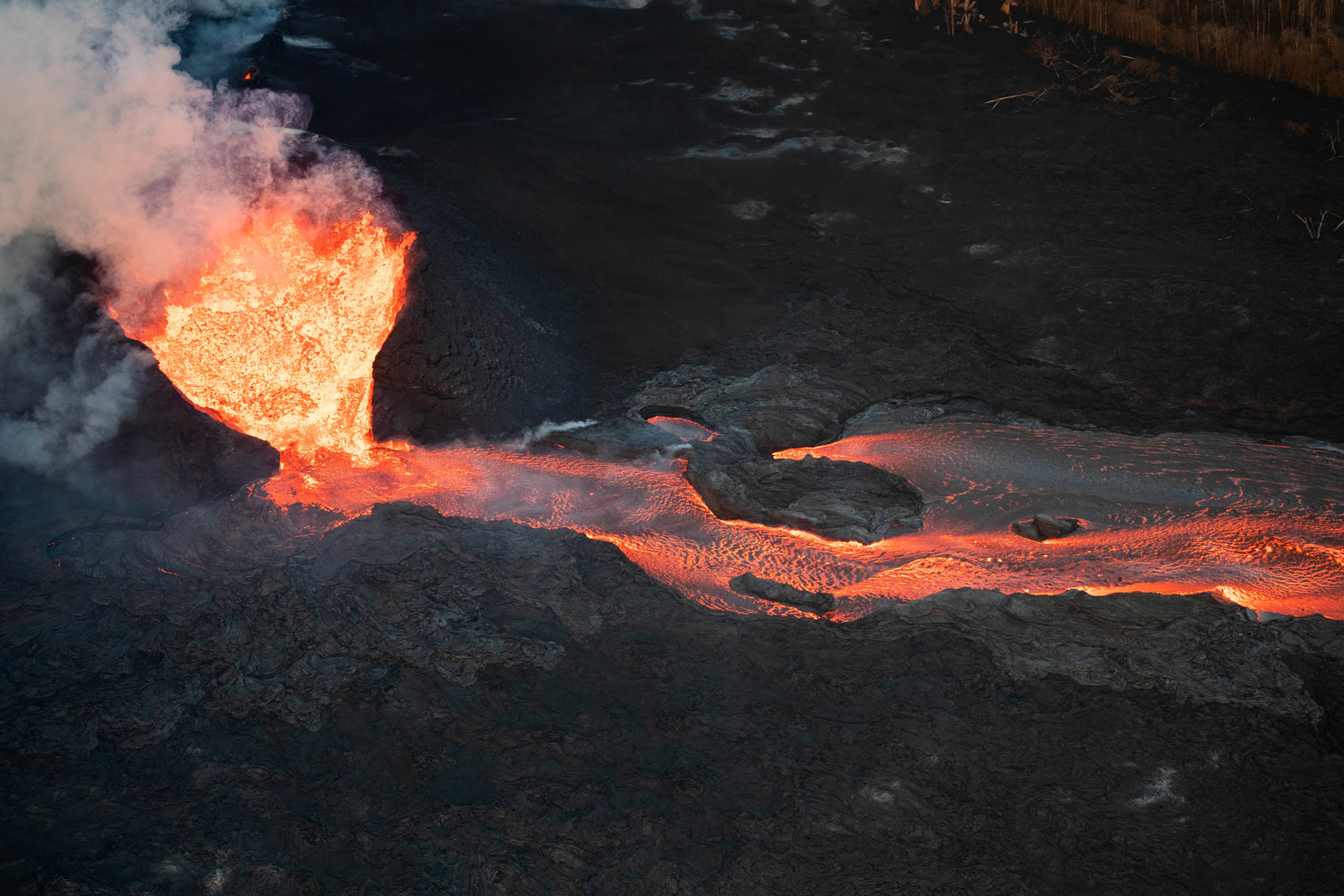
Lava has spurted as high as 270 feet from fissures like this one.
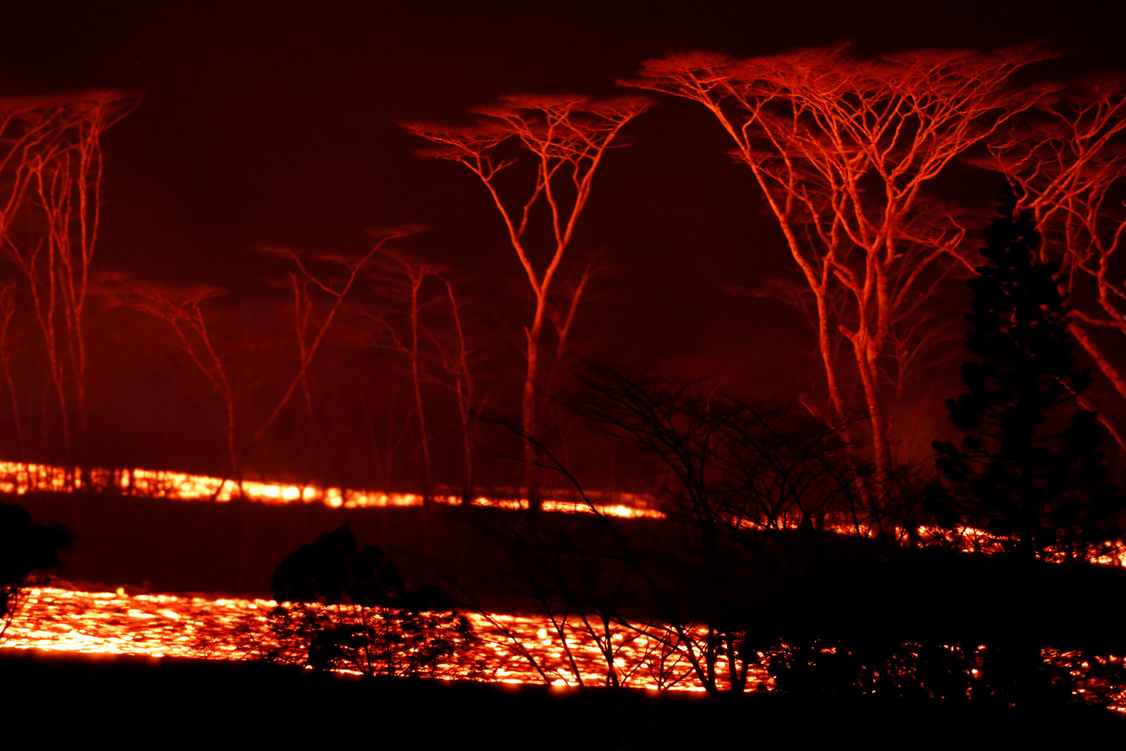
A river of lava is flows behind trees during the night.
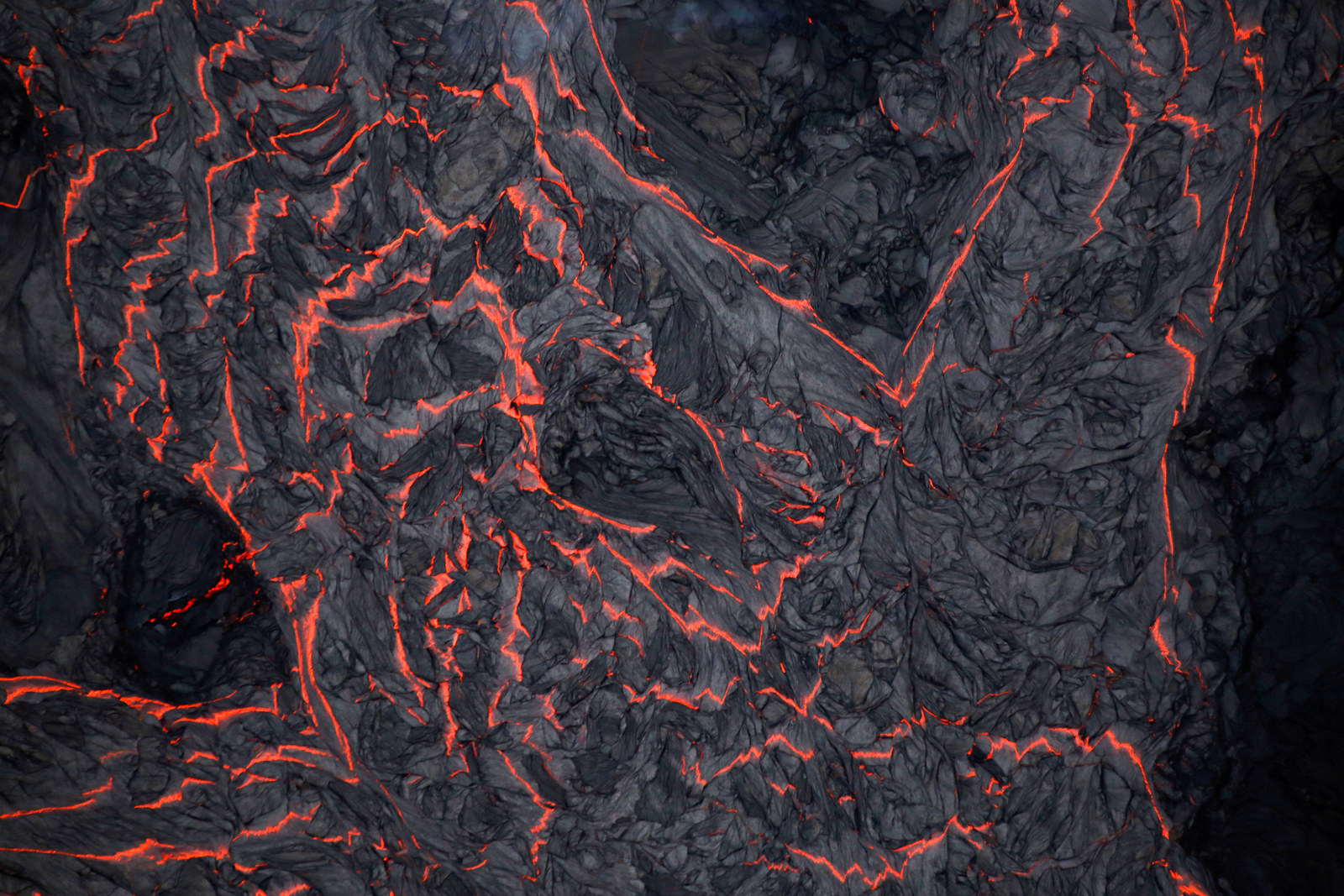
An aerial view of a river of lava, with some of it hardening on top.
Hawaii's Kilauea volcano has now formed 390 acres of new land.


Comments
Post a Comment